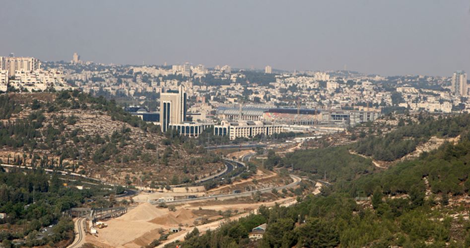
On a high hill to the west of the south of occupied Jerusalem the town of Al-Walaja is standing with its trees and orchards and old houses defying the cruelty of the Israeli occupier which divided it in 1948.
Only eight kilometers separates the town of Al-Walaja from the city of Jerusalem overlooking a beautiful valley that is full of walnuts almonds olives figs and grapes.
A valley that is full of life. It is the Valley of Al-Sarar which used to have a railway connecting Jerusalem and Jaffa. A road leading to this valley connects the village to the city of Jerusalem. Its name Al-Walajh in Arabic comes from the roots of getting deep into something which reflects the location of the village in the mountains and deep valleys.
God’s paradise on Earth
The beauty of the village’s agricultural terraces its graceful trees and fresh water-wells made its inhabitants describe it as the “Garden of God on Earth”. Al-Walaja used to get its supplies of water from five springs to provide for its orchards which produced vegetables and fruits of all kinds which ended up in the markets of Jerusalem Jaffa and Haifa. Some of these vegetables used to be exported by traders to Riyadh Kuwait and Beirut. However the exports stopped due to the procedures of the Israeli occupation
Its God given beauty completes the beauty of its strategic location. It is only eight kilometers to west of the occupied city of Jerusalem. The village’s average altitude is 750 meters while the village used to be made of 17708 dunums of land before the Nakba.
Most of the inhabitants of the town are Muslims. There is a large mosque called Al-Arbaeen Mosque in the village. Today there are about 3000 inhabitants living there. The occupation allows construction in 50 dunums of the total land of the village. The rest of the land is classified as Area C according to the Oslo Accords between Israel and the PLO where construction is prohibited except after obtaining approval from the Israeli High Organizing Committee which often does not allow anyone to build and those who do so without obtaining a license get their houses demolished.
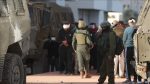
On October 21 1948 the town fell under Israeli occupation. The village was attacked by the Argun Stern and Haganah gangs at the beginning. However they failed to keep control of the village after they were confronted by irregular Egyptian fighters. Following the Rhodes Agreement of 3 April 1949 the Israeli occupation took control of some of its land as part of four villages west of Jerusalem that the occupation forces took over including Al-Walaja Beit Safafa Qabo and Battir.
The Armistice Line divided Al-Walaja as a large part of which fell under Israeli control following the 1948 Nakba. The West Valley where the beautiful water wells are remained under Israeli control. The other part remained under Jordanian control until the 1967 War. The Israeli occupation established Amindav settlement on its territory in 1950.

Settlements swallowing the village
According to a new Israeli planning scheme the Israeli municipality decided to increase its control over Al-Walaja lands by transferring its military barrier known as the Yalo Checkpoint further into the village’s lands which will prevent the residents from accessing hundreds of dunums of their fertile lands.
The Israeli occupation forces recently distributed a plan to confiscate two kilometers of lands of Al-Walaja meaning that the majority of the lands will be included inside the Yalo checkpoint. This means that the confiscated land will be annexed to occupied Jerusalem thus confiscating some 2000 dunums of its land including the historical town in the village which the residents feel proud of.
The mayor of Al-Walaja Alaa Dras said that what the occupation is planning means an intensified wave of settlements in the village and the confiscation of thousands of dunums of its fertile land.
He told the PIC “We were surprised that the planning committee of the municipality of occupied Jerusalem asked the Israeli military and security to transfer the Yalo checkpoint to the west of occupied Jerusalem to the depth of the Al-Walaja’s lands! This means confiscating 1500 dunums that will be behind the checkpoint and annexing them to Jerusalem all of which are fertile agricultural lands. This also means the confiscation of important and historical water springs such as Ain al-Hania the only remaining water-well in the village. In addition the plan will include the confiscation of 500 dunums around the checkpoint designated as a military zone which Palestinians are not allowed to approach.”

Greater Jerusalem
Khalil Al-Tafkaji an expert of maps and settlements in Jerusalem said that the expropriation of Al-Walaja lands is part of the Greater Jerusalem plan that the occupation has been working on for decades.
He explained to the PIC that the transfer of the Yalo checkpoint is not a security issue as much as a settlement plan that paves the way for the confiscation of about 2000-3000 dunums which will be annexed to Greater Jerusalem.
He added “The occupation extends systematically around Jerusalem. It extended to the east by confiscating Abu-Ghunaim Mount from the lands of Bethlehem and extended to the east and south and is working to annex the settlement of Etzion and Tekoa. It is building the settlement of Giv’at Ze’ev from the land of Ramallah and is trying to annex it to West Jerusalem. Today it is planning to control and confiscate thousands of dunums from Al-Walaja to the west of Jerusalem so that its Greater Jerusalem plan is completed!”