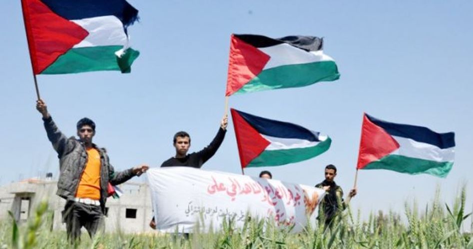
Land Day is a Palestinian national occasion during which the Palestinian people celebrate this anniversary in historical Palestine (27009 sq. km) and in the diaspora.
March 30 1976 was a historical turning point in the history of Palestine which contributed to strengthening the unity of the Palestinian people in defending the lands of their ancestors and on working for their return of Palestinian refugees to these lands.
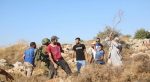
The events of Land Day began in 1976 following the Israeli confiscation of thousands of dunums belonging to Palestinians in 1948 occupied Palestine following a decree issued in the mid 1970s by the Israeli authorities known as “Development of Galilee Decree.” The main aim of this decree was to Judaize the Galilee. This decree resulted in protests and a general strike from the Galilee in the north to the Negev in the south. Clashes erupted following those protests resulting in the martyrdom of six Palestinians and the injury and arrest of hundreds of Palestinians.
According to statistics released by the Supreme Follow Up Committee which represents Palestinians in 1948 occupied Palestine the Israeli authorities have confiscated nearly one and a half million dunums of land since the creation of “Israel” on the land of Palestine in 1948 until 1976. Palestinians in 1948 occupied Palestine were only left with a half million dunums along with millions of dunums of lands belonging to displaced refugees and that of the state’s lands.
Before 1948 known as Nakba most Palestinians were farmers where 75% of Palestinians depended on farming their lands to afford for food and living. Following the Nakba in 1948 land has played a major role in the lives of 156000 Palestinians who remained in occupied Palestine. Land has served as an important symbol for the steadfastness and belonging of Palestinians to their cause.
Palestine’s geography
Palestine is located at the eastern coast of the Mediterranean at 34.15° to 34.40° E longitude and at 29.30° to 32.15° N altitude. It shares borders with Syria and Jordan from the east and to the north it shares borders with Lebanon and parts of Syria. From the south it shares borders with Egypt and the Aqaba Gulf at the red sea. The total surface of Arab Palestine is 27009 sq. km.
Despite the small area of Palestine and the simplicity of its geographical combination it could be divided into four different and distinctive geographies which have different plantations climate and surface. They are: 1. Hilly areas: The most important of which is the coastal hills and the Marj Ibn Amer hill which together make 17% of the total area of Palestine. 2. The Negev desert area which makes 50% of historical Palestine. 3. Mountains areas which make 28% the total surface of historical Palestine. 4. The Jordan Valley area which makes 5% of the total area of Palestine.
During the British Mandate of Palestine in July of 1939 Palestine was divided into six different areas. They are: The Galilee area which is located to the far north of Palestine near the Lebanese borders with Nazareth as its capital city. This area is divided into five different districts: Acre Bisan Nazareth Safad and Tiberias. The population of the area stood at 231000 in 1945. Its total area was 2801383 dunums which makes 10.4% of the total surface of Palestine.
The Haifa area consists of Haifa city and its surroundings. Its total area is 1031755 dunums which makes 3.8% of the total surface of Palestine. Its population stood at 242630 in 1945.
The Nablus area with Nablus as its capital city which consists of 3 districts: Nablus Jenin and Tulkarem. Its total area is 3262292 dunums which makes 12.1% of the total area of Palestine. Its population stood at 232220 in 1945.
Al-Quds area located in the middle of Palestine with Jerusalem as its capital city. The area consists of five districts: Jerusalem Bethlehem Hebron Jericho and Ramallah. Its total area is 4333534 dunums which makes 16% of the total area of Palestine. Its population stood at 384880 in 1945.
The Lod area located to the north-west of Jerusalem with Jaffa as its capital city. It consists of two districts: Jaffa and Ramla and most of its lands there are hilly. Its total area is 1205558 dunums which makes nearly 4.5% of the total area of Palestine. In 1948 its population stood at 501070.
The Gaza area which is located to the south of Palestine includes parts of the Palestinian coastal hills and the Negev area whose surface equals 50% of historical Palestine. The capital city of the area is Gaza and it includes two districts: Gaza and Beer Al-Sabaa. The total area of the area is 13688501 dunums which makes 50.7% of the total area of Palestine. Its population stood at 190880 in 1945 which means 15 people per square kilometer.
Israel controls 85% of historical Palestine while Palestinians were left with only 15% of lands. With the Israeli occupation dividing Palestinians among various geographical areas Palestinians in historical Palestine make 48% of the population which means that Palestinians own one fifth of land compared to Israelis.
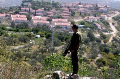
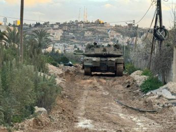
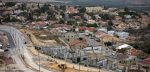
The Israeli occupation authorities approve hundreds of housing units in colonies built on Palestinian lands each month. Campaigns of Judaization and displacement against Palestinians are ongoing as evident in the increasing demolition of Palestinian houses and the destruction of their plantations and appropriation of more lands.