The Israeli settlements expert Khalil Al-Tafkaji warned that the Apartheid Street opened by the Israeli authorities in occupied Jerusalem as part of the Ring Road is connected to a large settlements plan to cut it off the rest of the occupied West Bank.
Al-Tafkaji said in a press statement on Friday that the aim of this road is to link the Israeli settlements located within the borders of the Israeli occupation municipality in Jerusalem with those outside its borders and the Apartheid Wall.
He noted that “this street stretches from the south of the city to the north towards Street 70 which is part of the Eastern Ring Road implemented throughout different stages.”
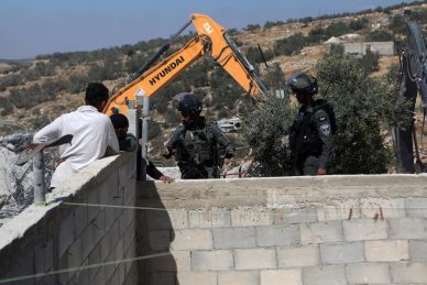
He pointed out that there is an Israeli tendency to close the areas of Alezariya and Abu Dis from the roundabout of Ma’ale Adumim side linking them along with the Eastern Sawahra area via the Al-Za’im military checkpoint. According to him this will be possible by digging a tunnel near the crossing which will allow Palestinians to enter Anata and the Shufat refugee camp to reach Jaba.
He warned that “these projects and roads may be a prelude to the start of the construction of major settlements in East Jerusalem in area ‘E1’ which aims to isolate the holy city from the occupied West Bank by linking Jerusalem to the settlement of Maale Adumim the Dead Sea and completely isolate Jerusalem from its Palestinian surroundings.”
He said: The separation and isolation of Palestinians in the Jordan Valley and the closure of Road One completely in front of the Palestinians paves the way for annexing the Jordan Valley completely.
He stressed that this area falls within a plan called Jerusalem 2050 which aims to cut the remaining West Bank into two blocs; a block in the north and an isolated bloc in the south torn apart by more settlements.
He added that the project aims to empty the eastern slopes of Jerusalem completely all the way to the Dead Sea and therefore the Israeli focus will intensify on the Bedouin communities in this region in the next stage.
According to the plan of the Israeli occupation a military barrier will prevent Palestinian residents of the West Bank from entering Jerusalem and as a result Palestinian drivers will travel on the Palestinian side of the street around Jerusalem from the east without being allowed to enter.
It is expected that the majority of Apartheid Street users will be residents of settlements that were forcibly established on land north of Jerusalem.
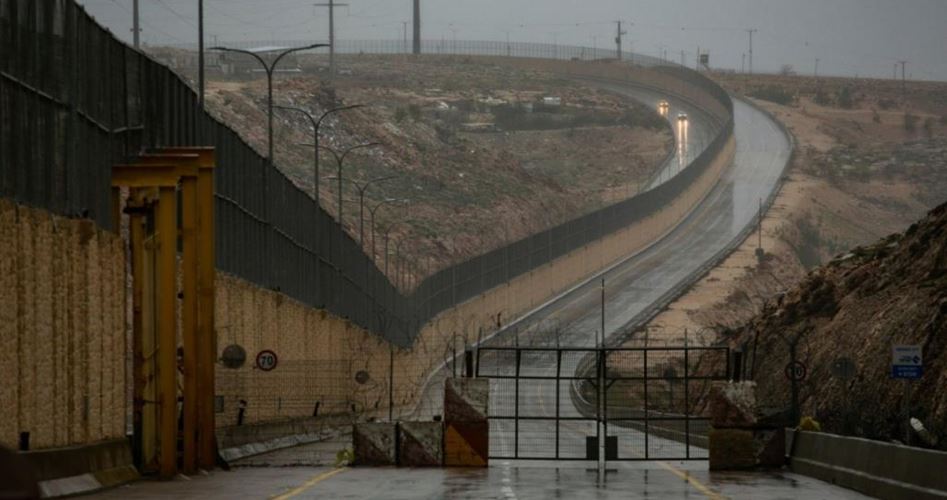
The Israeli Ministry of Transportation opened the road north-east of Jerusalem a couple of days earlier which exposes its policy of apartheid that is based on separating Palestinian drivers from Jewish settlers through a wall up to eight meters high.
The 4370 road connects the Giv’at Binyamin settlement also known as the Adam settlement built on the land of the village of Jaba. It is connected to Road One or Tel Aviv-Jerusalem Road. It is located between the junction of the French Hill settlement and the tunnel leading to Mount of Al-Masharif and it is three kilometers and a half long.