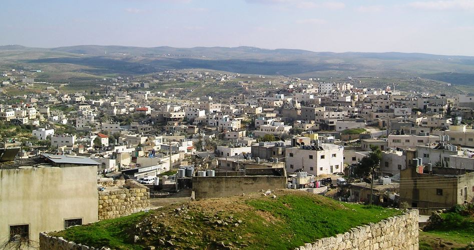
Some 12 km to the south-east of Al-Khalil (Hebron) city the city of Yatta is located occupying an important site to the south of Al-Khalil governorate in the West Bank serving as a connecting point between the high mountains of Al-Khalil in the north and the flat Negev area in the south.
Yatta is considered to have the third largest Palestinian population in the West Bank in terms of area and the number of population coming in ranking after the cities of Al-Khalil and Nablus. The total area of the city is 180000 dunums 32000 of which are located inside the borders of the local council to be one of the largest cities in the West Bank.
Archaeological sites
The city has a number of archaeological historical and religious sites such as Al-Umari Mosque and Al-Khadir Shrine which is located in Beit Amra area and Staih Shrine located in the city’s center.
The ruins of Al-Karmel palace and the remains of a mosque and a church in the Susiya area are among those relics. There archaeologists found old scripts and writings where lands were paved by colored Mosaic. This last site is under the Israeli occupation as it is located near the southern Israeli settlements.
City’s history
The city’s history goes back to the Canaanites as ancient Canaanites inhabited the area and called it Yuta meaning the flat land. The inhabitants of the city speak of old stories which state that the city was inhabited by Prophet Zechariah (PBUH) and where his son Yahia (John) (PBUH) was also born. Mariam (Mary) Prophet Issah’s mother also visited the city to call on her relative Um Yahia (mother of Yahia).
The chairman of Yatta city’s local council Nasser Al-Rubaia told the PIC “the borders of the city to the east is near the Dead Sea and to the south is near Tel Alsabaa as the hills of Arad are located within the borders of the city and from the north it is surrounded by the city of Al-Khalil (Hebron) and from the east is Alsamou village and Fawar refugee camp and Dura city.
Rubaia asserted that the city is witnessing a population growth faster than all other Palestinian cities in the West Bank with a 5% total annual population growth which impacts the city’s infrastructure either in planning or in educational sectors which poses a real challenge to the governmental institutions in relation to services and suitable healthcare to locals.
Rubaia noted that with this population growth the city is facing a clear negligence in providing services and development stressing that the government should take into consideration when distributing services the number of population and the city’s borders compared to other West Bank cities.
Educational sector
Yasser Abuiram an administrator at the Educational Department at the Ministry of Education in Yatta explained the situation of education in the city noting “the number of students in the city is 23639 scattered among 70 schools and two private schools and a school for the deaf. Governmental schools have 287 classes for boys 312 for girls and 259 mixed classes.
Abuiram asserted that the Department of Education in the city opens 5-7 primary schools annually in the city due to the population growth and the geographical extension of the city which requires a long time from students to reach their schools.
Economic life
In this context Rubaia assured that the residents of the city depend on working inside the Green Line to make their living in addition to herding the sheep which makes 45% of the total number of sheep in the governorate of Al-Khalil.
The city is famous for making white stones used to decorate the external fronts of houses and its good-quality stones are known as Yatta stones.
Masafir Yatta
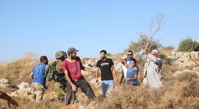
Rubaia pointed out that the Masafir Yatta which are Bedouin-inhabited area serves as the first defense lines with the southern part of the city has four Bedouin communities and the rest are scattered in the northern and western parts of the city.
These communities are connected to the city of Yatta geographically and demographically and they belong to the same families inhabiting the city of Yatta as their presence prevents controlling and confiscating the area by the Israeli occupation authorities (IOA).
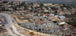
Settlements surround the city
Rubaia concluded that there are many Israeli settlements built on the lands of the city which surround it from all directions where bypass road number 60 is built which connects settlements located in the southern part of the city separating the eastern parts of the city from the western parts. The city is surrounded by three Israeli settlements.
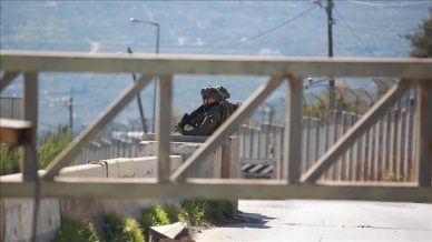
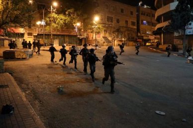
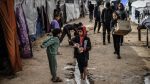
Furthermore the IOA imposes internal closures in the city’s center and communities associated to it. It also imposes an external closure on moving between Yatta city and other surrounding cities in the West Bank which creates obstacles in the face of developmental plans and causes economic losses to the Palestinian citizens.